Photo: Juliancolton / Wikimedia Commons, Public domain
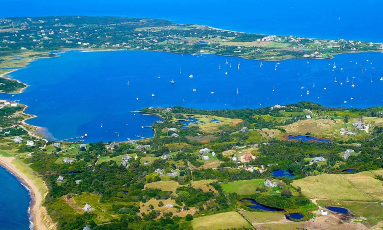
A string of shallow coastal lagoons lies behind the barrier beaches of South County: Winnapaug and Quonochontaug ponds, Ninigret Pond, Green Hill Pond, Trustom and Cards ponds, and Potter and Point Judith ponds. Ninigret, in Charlestown, is the largest of them. Together they are some of the most productive and most closely watched waters in Rhode Island.
What a breachway does
Most of the ponds connect to the ocean through breachways, channels through the barrier beach. Several were stabilized with stone jetties in the 20th century to keep them open for boats and to flush the ponds with seawater. The Charlestown Breachway links Ninigret Pond to Block Island Sound. Tides move water and sand through the channels, which affects salinity, water quality and the habitat for fish and shellfish.
Who manages them
- Coastal Resources Management Council: its Salt Pond Region Special Area Management Plan sets rules for development and activities around the ponds and their watersheds.
- Department of Environmental Management: manages shellfishing, water quality monitoring and closures, and fishing regulations.
- Federal agencies: the U.S. Fish and Wildlife Service manages Ninigret National Wildlife Refuge on the pond’s shore, and the U.S. Army Corps of Engineers has worked on habitat restoration.
- Towns and nonprofits: Charlestown and neighboring towns manage local land and septic rules, and the Salt Ponds Coalition monitors water quality with volunteers.
The issues
Nitrogen from septic systems and fertilizers can fuel algae growth and reduce oxygen in the ponds, so towns have adopted wastewater rules for properties near the water. Sand carried through the breachways builds up shoals inside the ponds, changing currents and habitat; restoration projects have removed sand in some areas. Eelgrass beds, important nursery habitat, have declined in places, and efforts to restore them continue. The ponds also support oyster farms, which are licensed through CRMC.
Enjoying the ponds
Ninigret Park, the refuge trails and the Charlestown Breachway beach and campground offer access. Shellfishing requires a license and close attention to DEM’s closure maps, which change after heavy rain.