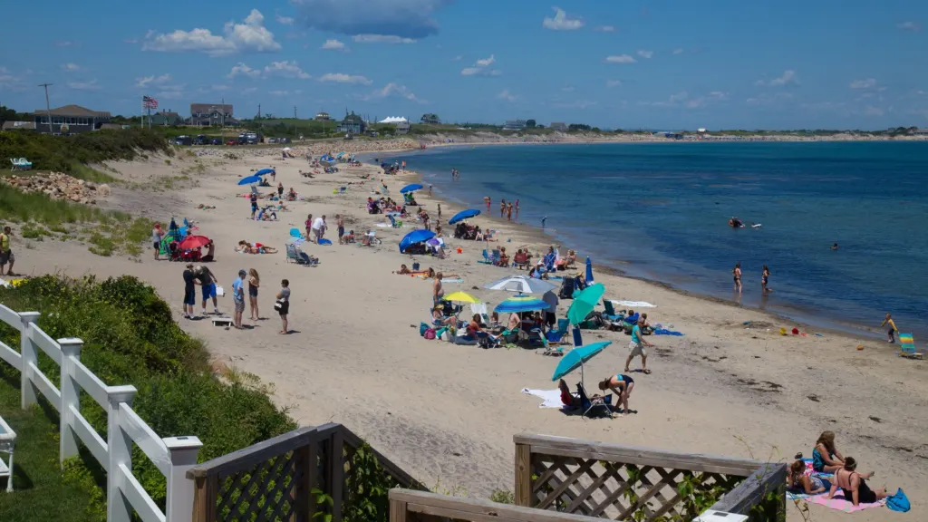
Crescent Beach on Block Island, where a CoastSnap photo station now stands at the north dune walkover. Photo: Timothy J. Quill, CC BY-SA 4.0, via Wikimedia Commons.
Block Islanders who want to know whether the water is coming up Corn Neck Road no longer have to wait for someone to drive out and look. Three flood sensors, a smartphone photo stand at Crescent Beach and two utility-run weather stations now post their readings online, free and in close to real time.
Most of the tools went in this year, and the island is now heading into nor’easter season. Together they give the town something it has mostly lacked: a running record of how high the water gets, where, and how the beaches respond.
The Block Island Times laid out the projects on Nov. 16. Here is where each one lives and how to use it.
The flood gauges in the pond and on the roads
Brown University’s Network for Environmental Sensing and Technology, known as NEST, launched in March with nearly 100 sensors around Rhode Island tracking tides, streams, flooded streets, air quality and weather. Narragansett is one of the coastal towns that worked with the Brown team on where to put them.
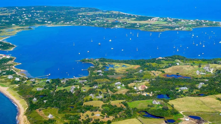
On Block Island, Brown research associate Sol Cooperdock installed three sensors this spring, according to the Times: one in the Great Salt Pond and two over land in spots that are known to flood. The Nature Conservancy helped the university and the town pick the sites. The pond gauge sits on the BIMI dock, and its readings also appear in the regional NERACOOS ocean data catalog, measured against a fixed land elevation so storm surges can be compared from one event to the next.
All of it shows up on the NEST dashboard, which also pulls in NOAA water levels and National Weather Service wind and temperature data. Users can look back at past readings and sign up for email alerts when a particular sensor reaches flood level. That last feature is the practical one for anyone who parks near the water during a storm.
Cooperdock said in Brown’s March announcement that emergency managers “often have to go out with measuring sticks during flooding events to measure water levels,” and that the dashboard gives them continuous data instead of snapshots.
A phone mount at Crescent Beach
The second tool asks beachgoers to help. A CoastSnap station, a fixed phone cradle, stands at the northernmost wooden dune walkover near Beach Avenue and Corn Neck Road. Researchers supported by Rhode Island Sea Grant installed it with the Town of New Shoreham.
The idea is simple. Set your phone in the mount, take a picture and upload it. Because every photo is taken from exactly the same spot, researchers can stack them over months and years to see how storms, seasons and rising seas move the beach and dunes. Uploads go through MyCoast Rhode Island, the statewide photo-reporting program, which also collects storm-damage and king-tide pictures. MyCoast says Rhode Island users have filed 7,075 reports with 14,840 photos so far.
Crescent Beach is the island’s busiest stretch of sand, and the same dunes that frame it are the ones that take the hit in a winter blow. Readers who have followed Matunuck’s long fight with erosion on the mainland will recognize why a photo record matters before decisions get made about sand and walls.
Weather from Corn Neck and Beacon Hill
The Block Island Utility District has added two weather stations, one on Corn Neck and one on Beacon Hill. Their readings, updated every 10 minutes with temperature, wind speed and gusts, humidity and rainfall, are posted on the utility district’s weather network page. For ferry riders watching the wind before a crossing, it is a closer look than the mainland forecast. Our guide to getting to Block Island year-round lists the ferry lines and their winter schedules.
Volunteers have also been measuring dune heights around the island for years using the Emery method, a low-tech surveying technique that tracks changes in beach profiles. That work has been coordinated by Bryan Oakley of Eastern Connecticut State University and Nathan Vinhateiro of the University of Rhode Island. The researchers have added drone surveys, GPS measurements and sediment samples, and the URI team is building an online database to put it all in one place.
That database gets its first public look at the town’s Coastal Resilience Committee meeting on Thursday, Dec. 3, at 3 p.m. The meeting will also stream on the town’s YouTube channel. More coverage of the island is on our Block Island page and in the Coast & Water section, including this fall’s Great Salt Pond scallop season.
Add South County Independent as a preferred source on Google (opens in a new tab)